
Walk a Bend Street by Address
A search along a Bend street begins with the address itself, but the strongest result is usually a chain of records rather than a claim about a household. Deschutes County's DIAL property system turns a situs address into an account number, map/taxlot, legal description, and owner or mailing information. Those identifiers let a reader check the parcel map and locate related recorded documents. A tax-account owner, a permit contact, and a historical directory subscriber describe different relationships to an address. Keeping those labels separate makes the street directory useful for property history, family research, estate questions, and neighborhood curiosity without overstating who lives at a location.
- Search the full or partial situs address in DIAL. Save the account, map/taxlot, situs, subdivision, and legal-description details that appear on the parcel record.
- Open the parcel record and distinguish the property situs from the owner mailing information. A mailing address can belong to a manager, fiduciary, government office, or an owner elsewhere.
- Use the DIAL Interactive Map and County GIS layers to place the parcel within its road, subdivision, city-limit, and urban-growth-boundary context.
- Search the current owner or recording citation in the Clerk's Digital Research Room, then match the legal description before treating a document as part of the same parcel trail.
- For an older address association, ask the Deschutes Historical Museum about a relevant city-directory, phone-book, or reverse-directory edition and compare it with maps, permits, or deeds from the same period.
The last step matters. A historical listing can identify a subscriber or address lead, while a recorded deed establishes a transaction. Neither one automatically proves present occupancy. For a current property question, follow the parcel and document route first. For an old household lead, preserve the edition year and page or image citation before comparing it with other dated sources.
Use DIAL for the Bend Street Directory
DIAL's Property Address search accepts a full or partial situs address. County examples include a house number with a directional street name, which is important in Bend because prefixes such as NW, NE, SE, and SW are part of ordinary official addresses. The results begin with parcel information, not household names. They show such fields as map/taxlot, account, owner name, situs address, city, subdivision, and property type. A reader can narrow results by City, ZIP, Direction, Street Name, Street Type, Subdivision, or Property Type without turning a postal filter into a municipal-boundary claim.
| DIAL field or mode | How it works | Street-directory use |
|---|---|---|
| Property Address (Situs) | Full or partial property address | Find the parcel account for a Bend street number. |
| Owner Name | Full or partial owner name | Check a recorded owner after an address search. |
| Map / Taxlot | Full or partial identifier, without spaces | Carry the parcel key across map, tax, and document work. |
| Subdivision | Full or partial subdivision name | Separate similar street names or trace a platted area. |
| Interactive Map | Map-based parcel and land-use view | See surrounding tax lots before opening each record. |
See the County's DIAL situs-search screen before entering an address with a directional prefix or unit. It shows the address-query route used for a Bend street directory search.
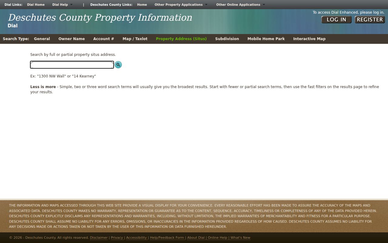
The screenshot reflects the address-first entry point. Once a result opens, use the account and map/taxlot as the stable identifiers rather than relying on the spelling of a street alone.
Results default to 25 rows and can be changed to 50, 75, or 100. The row filters are useful for studying a segment of a street, but renters and other household members are not an output of the tax system. The parcel record can show owner mailing information, sales links, tax-map reports, valuation, and legal-description text. Its mailing and situs fields should always be read as separate facts.
Bend Address Keys Beyond Street Names
A street name alone can join the wrong records. The DIAL account supplies the keys that travel between County systems: an assessor account, map/taxlot, situs address, and legal description. A legal description identifies land through a subdivision and lot/block, a metes-and-bounds description, a partition plat, or another recorded reference. It is not interchangeable with a tax-lot number or a mailing address. Match more than one identifier before treating a permit, map point, or recorded instrument as the same Bend property.
- Parcel
- A defined piece of land represented by a map/taxlot and tax-account record.
- Situs address
- The physical property address used by the assessor, distinct from where an owner receives mail.
- Plat
- A recorded map that lays out a subdivision, lots, blocks, streets, or easements.
- Criss-cross directory
- An address-arranged directory, when a particular historical volume includes that arrangement.
Bend's growth makes the distinction especially useful at the edge of the City. The 2016 urban-growth-boundary expansion added 2,380 acres, and a Bend mailing label may point to City territory, County territory, a PO Box, or land within the UGB but outside City limits. Check DIAL's City field and the County map layers before choosing the CityView or County channel for an address record.
Note: Keep the directional prefix, house number, street type, map/taxlot, and legal description together when comparing an address across Bend records.
Map a Bend Street Segment
The Deschutes County GIS data portal provides more than 60 publicly available layers, updated weekly, while DIAL Interactive Map is the practical browser route. County layers include city limits, the urban growth boundary, roads, subdivisions, unincorporated communities, school and service districts, and census geography. Use them to understand land and jurisdiction around a street segment. They provide spatial context, not a list of people at the addresses.
For a careful Bend street search, open the focal parcel first, then inspect nearby tax-lot geometry and return to DIAL one account at a time. A boundary line, subdivision, lot/block, and legal description are stronger evidence of a shared location than a street-name assumption. The live map controls are JavaScript-driven, so the documented route is map context followed by individual parcel verification rather than a promise of a particular click or buffer tool.
County map layers also help sort City and County responsibilities. An address in CityView jurisdiction can have City property or permit material, while a nearby County parcel may be best documented through DIAL or County records. The map should guide the next record search, not replace it.
Bend Records Tied to an Address
Address-keyed sources answer different parts of a Bend street directory question. DIAL is the main property entry point. The Clerk's index is a party-and-citation system, so it is normally searched after DIAL supplies an owner name, map/taxlot, legal description, subdivision, lot/block, or a sales clue. CityView can add selected City project history. The voter-list route is formal and limited by statute, not a street-by-street public browser.
| Address record | Custodian | What it can establish | Access path |
|---|---|---|---|
| DIAL property account | Deschutes County assessor/tax system | Parcel, owner or mailing name, situs, tax, sales, and map links | Free standard DIAL access |
| GIS map and data | Deschutes County GIS | Parcel geometry, roads, districts, subdivision, and boundary context | Interactive Map or GIS data portal |
| Recorded documents | Deschutes County Clerk | Document party, date, number or book/page, and ownership chronology | Digital Research Room, historic research pages, counter, or copy request |
| Permit and project records | City of Bend or County DIAL | Tax-lot activity, selected contacts, permit, inspection, or work history | CityView, Permit Center, or records request |
| Historical directory volume | Deschutes Historical Museum | Dated subscriber or address lead where the edition supports it | Appointment and edition-level inquiry |
| Formal voter file | County Clerk Elections | Limited public elector data permitted by law | Written County request, not a nearby-voter interface |
The sequence is address to parcel, parcel to recorded or City records, then date-specific local sources where needed. For a modern single-person question instead of an address trail, the Bend resident lookup applies a different verification workflow.
Note: Treat an owner mailing name as a recorded contact clue, never as proof that the person occupies a Bend address.
Follow Bend Street Records to Deeds
The Deschutes County Digital Research Room covers Official Records from 1983 forward. It requires acceptance of a disclaimer and a CAPTCHA before the live form. County instructions document basic searches for last or business name, first name, year and number, and recording-date range; Advanced Search is the route for book/page research. Use a party name or citation after confirming the parcel identifiers. The recorder is not an address roster, and a deed chain is not a complete resident list.
View the Digital Research Room entry screen before beginning a document search. The screenshot records the Clerk's public access flow.
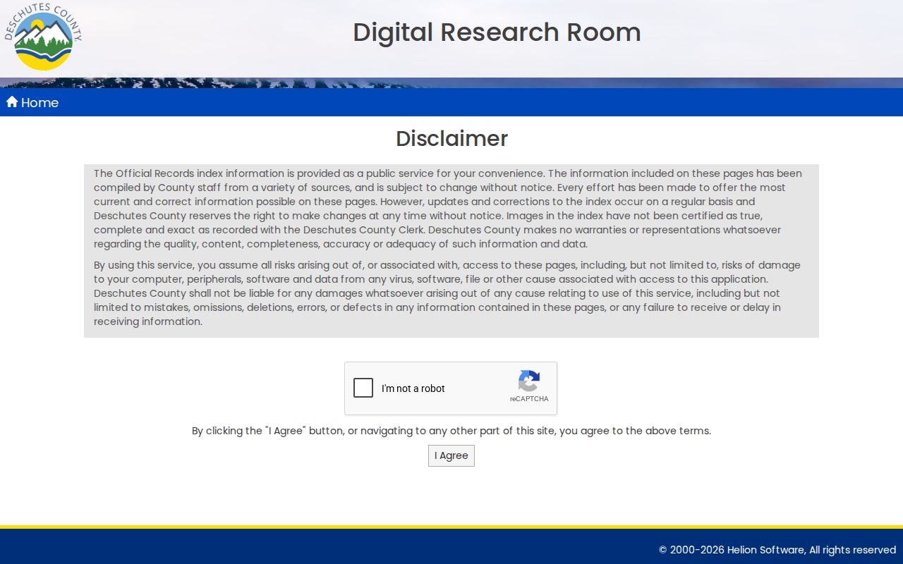
The image illustrates the Clerk's official research entry point. A current online result or image is not a certified copy, and the exact advanced options should be confirmed within the live portal.
Older work has a local date split. Digitized Deed Records span 1871 through 1982, and the direct and indirect deed indexes span 1871 through 1984. The County Records Research pages provide historic routes, while the Clerk counter and mailed copy procedure remain available when an online index or image is incomplete. A copy request can name a recording number or book/page, parties, and document type; the form says to allow 10 days. Certified copies can be requested by mail or at the counter.
Check Bend Street Permit History
CityView Permit Locator accepts an application number, address, tax-lot number, or the name or address of a contact on a permit. The City says its separate Permit Lookup Tool reaches historical City permits from 1993 forward. For earlier City permit material, contact the Permit Center rather than assuming the online screen is complete. The Permit Center offers walk-in and phone assistance, and City payment channels include the portal, counter, and mail.
County DIAL may also show development, permit, inspection, work-description, subdivision, floodplain, and related tax-lot material where the County is the better jurisdictional source. Permit contacts identify a project relationship. They do not establish that the contact owned or occupied the property. When an older City record is not visible, a specific request through Bend JustFOIA can seek existing property or permit-history records and may trigger a cost estimate.
Bend Street History Has Record Breaks
Deschutes County's long property record span is a useful Bend street-directory detail. Deed Records reach 1871, Official Records begin in 1983, and the County holds 44 R. B. Gould field books from 1910 through 1940 covering more than 60 subdivisions. These sources answer separate questions: a deed or recorded plat documents a legal transaction or boundary, while the field books and historic maps help place roads, monuments, and subdivisions in time.
The County formed from Crook County on December 13, 1916. Its first 19 deed volumes include transcribed Crook County material, so an early title trail may need Crook County or State Archives context. The City also makes Sanborn map sets for 1913, 1917, 1920, and 1928 available through its historic-site maps. A Bend city directory search is the appropriate next stop for the historical directory collection itself; the street trail should only use a confirmed edition as one dated address lead.
Note: Record the series name, date, citation, and legal description together because an identical volume or page reference can belong to different Bend record series.
Label Bend Street Directory Evidence
A Bend street directory can join useful records only when each address relationship keeps its own label. The County's backward-trail guidance separates a current owner, a directory occupant or subscriber, a census household, a permit contact, and a probate heir. A Bend parcel record, recorded instrument, map sheet, or phone book may all point to the same property, yet each one describes a different fact and date. Preserve the source and the relationship instead of reducing every name in the trail to a present resident.
| Evidence label | What it means at a Bend address |
|---|---|
| Owner or recorded party | A property or document relationship that must be matched to the parcel and date. |
| Directory subscriber | A dated listing when a confirmed historical edition includes the address. |
| Permit contact | A connection to a project, application, or inspection, not proof of occupancy. |
| Map or survey context | Physical place evidence that helps align a street, lot, or building with the right era. |
This distinction also handles gaps honestly. A missing online result may call for the Clerk counter, a mail copy request, a City public-record request, an appointment with the Museum, or a library research visit. It does not establish that a Bend address had no prior association.
Bend Street Directory Privacy Limits
A Bend street directory cannot show every renter, household member, protected voter, vehicle address, utility customer, delivery customer, or a person's current whereabouts. DIAL shows property and tax information. A historical phone book or directory may show a subscriber at a point in time. Oregon's formal voter-list process has defined request parameters and protects exempt information; My Vote is a secure self-service voter tool, not a public street browser. A public record must remain tied to its own date, custodian, and meaning.
If a field is inaccurate, send the correction request to the office that maintains it. County public-record requests are for existing records and should describe them specifically; they are not a request for the County to conduct research. The relevant Deschutes County office, City department, or state custodian can explain its own correction and access process.